Hagansport, Texas History: 10,000 Years Along the Sulphur River
From The East Texas Journal, March 2017
By Hudson Old, Publisher
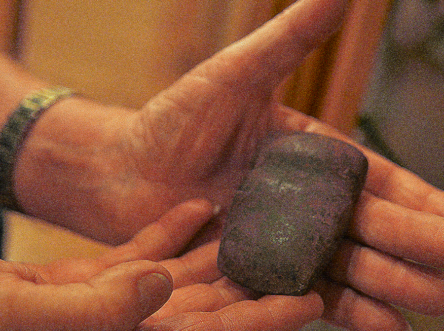
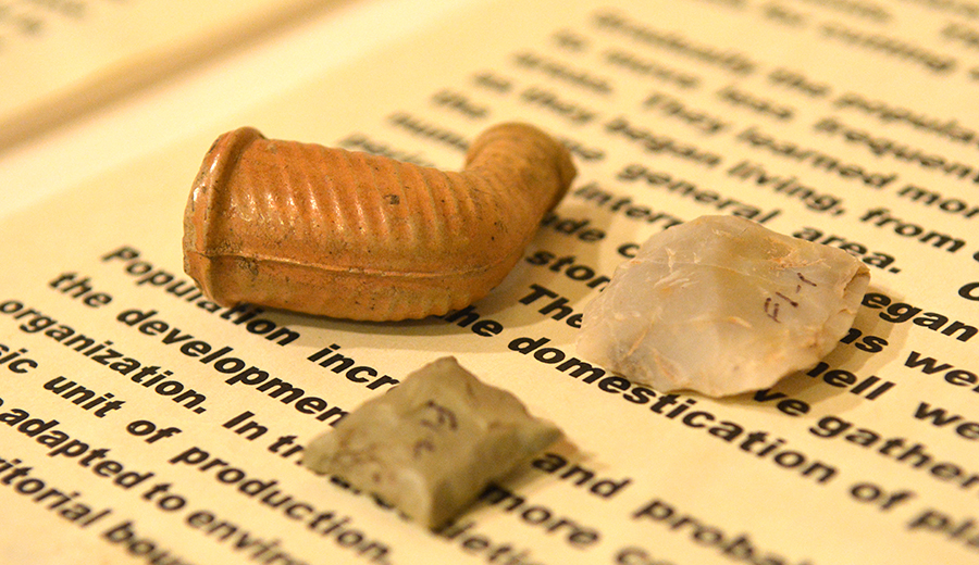
Consider the odds of a stone age ax winding up alongside a European-styled trade pipe likely manufactured in Pennsylvania in the late 1700’s being found not a spear’s chunk away from a flaked cube of flint from the times of the flint-rock rifle.
Flint rock rifle technology was an upgrade from having to have an ember at hand to ignite gunpowder measured into a flash pan creating the explosion shooting a ball of lead up an un-rifled cast-iron gun barrel.
Don Easterling’s work says the odds of artifacts spanning a 10,000-year time frame being found in the same place are likely enough if you just keep digging.
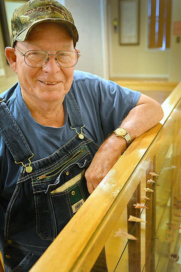
However it might have been known to hunter-gathering nomads, Mr. Easterling’s Hagansport community goes back 10,000 years according to what’s been left behind, gleaned from 50 acres starting on a September Saturday when he was 6, paying close attention to the earth and spotting an Indian “arrowhead” while pulling cotton.
Mr. Easterling has invested a significant part of his life digging up Hagansport’s hometown story.
The parts he hasn’t dug up he’s pulled from the archives of the Mt. Vernon Optic Herald.
Later, he was able to bring the story up to hogs sleeping under the school house and a resulting flea problem, as told in a rare copy of Hagansport School Master Xylander Carson’s autobiography, “My Autobiography by Xlander Carson.”
Where now cattle graze alongside pumpjacks sucking oil from under the earth here for the last 80 years, Mr. Easterling’s book “North Franklin County, The Beginning” cites Franklin County Court records of neighboring school districts at Eureka, Fairview, Lakeview and Wims in 1900 when Professor Carson arrived at Hagansport. There’s a map in the forward showing more than 20 communities between Goode’s Crossing on White Oak Creek and Hagan’s Ferry on the Sulphur.
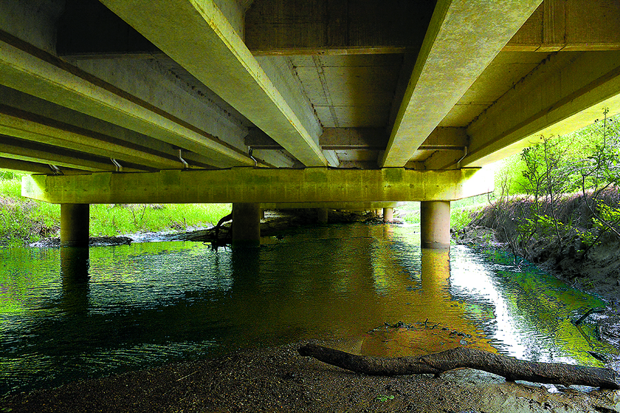
Educational issues were different in the horse and wagon era when Mr. Easterling’s map makes note of seven named low water road crossings and one highway bridge on White Oak Creek.
“Under the school at night, a lot of razorback hogs made their bed, forming a fat breeding place for millions of fleas hopping about during the day,” Professor Carson observed.
Allowing $50 a month for its faculty, the contract written my school trustees made no provision for teacher housing.
“No thought was given to the matter,” Mr. Carson wrote. “The teacher could rustle a house or get a tent. And he was no better than the children who had to walk, expected to get to the school house as best he could.
“But this was the attitude toward every phase of public service. The citizens said, ‘I have to take care of myself; you take care of yourself.’ Especially the teacher and the minister were in this category. It was a philosophy of live and let live, not live and help live.”
The rich black fields Professor Carson crossed walking to class turned to gumbo mud with every rain, “and I learned to negotiate it like a real Hagansportite before time came to leave the community for better soil conditions.”
A liberal, Professor Carson stirred political problems among traditionally conservative trustees by introducing recesses between 50-minute periods of his program of recitations and allowing a combination hour-long lunch and play time. Two trustees, “both doctors who believed in more work and less play” prevailed in the board room. Recesses and play time were discontinued.
“My program broke an old custom and that was a gross sin,” he wrote to conclude the matter.
Bounded by the river to the north and the creek to the south, he said the community had an ill-reputed name from its early days “more or less in the center of a section early infested with highwaymen, cattle and horse thieves and rough necks.” Two operating saloons when he arrived “didn’t help very much.”
His tone changed when speaking of students.
“In all my experience in the school rooms of the state, never have I met a better, more likely, more studious, more willing to do right group of children,” he said.
The school had a cistern that was often either dry or fouled by the bodies of drowned mice in search of water. The trustees furnished wood for the stove so that “as I remember no one froze during cold spells,” but water was another matter “and not easily found underground in this end of the county.”
Left to supply themselves, students brought water in jars.
“I formed the habit of drinking no water from the time I left home until I returned,” Professor Carson said. “This was not hard for me because I was a light water drinker to begin with and have been all my life.”
Earlier settlements on the sand ridges along the Sulphur River reflect the record of Caddo Indians as merchants and traders. They dealt in pottery, imported stone and armaments as their prowess in making bois d’ arc bows evolved.
On loan to Mt. Vernon’s Fire Station Museum are exhibits of stone used as currency that Mr. Easterling has recovered.
“Trade stuff includes different kinds of flint and chert coming from Arkansas, the Midwest and the Texas Panhandle area,” he said. “A big chunk of quality flint rock would be worked into essentially smaller denominations, roughed out into a production stage of tools and points.”
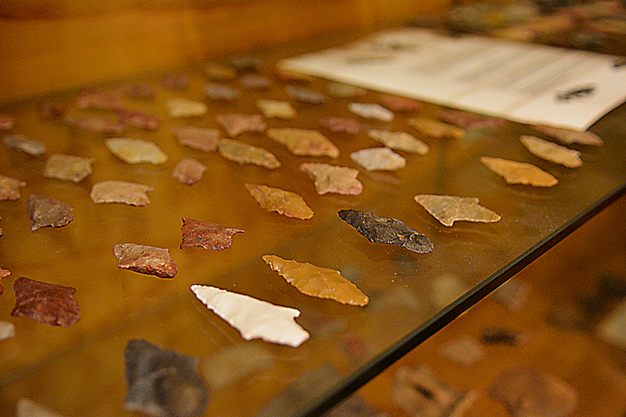
Of lesser value was chert, which tended to fracture rather than flake when worked.
“It has tiny irregular specs of quartz that make it brittle,” Mr. Easterling said. “The Caddo somehow figured a way to process it – they were ingenious and found that heating had good effect. They’d bury larger stones under just a layer of dirt then burn their fires over it for days. When they moved their fire they’d let the stone cool for days in the earth before working it into pre-forms used in trade.”
Ten miles downstream at Talco, near where the drilling of the Carr Discovery Well in 1936 began the oil boom, maybe the largest discovered Caddo community on the Sulphur was excavated at the sandy rise coming up on the south side of the river east of U.S. 271.
“The story I’ve heard is that in 1939 when the oil boom was rising to a height with companies scouring every acre, state archaeologists came in with crews and found truckloads of things. They identified an arrow point found in such abundance they named it the ‘Talco Point.’”
The points evolving from development of the bow and arrow beginning about 500 AD became smaller and lighter to more effectively balance the flight of their arrows. Some show signs have having been reworked from earlier styles.
Arranged by type and era in four cases on the second floor of the Mt. Vernon museum, artifacts from the 50 acres on the Sulphur between Hagansport and Talco include those associated with the earliest Americans.
“What’s unique is that I’ve identified 54 types of points,” Mr. Easterling said, styles associated with as many varying cultures and periods.
The trading pipe made in a mold and likely coming from Pennsylvania is an almost unique find.
“I know of one other like it, at a museum in San Antone,” Mr. Easterling said.
The pipe’s significant as an argument that Geezerplex Caddo trade networks had crossed into the world of Anglo settlers in the late 18th and early 19th century.
The stone age era of the seasonal passing of bands marks the time of a people who in Mr. Easterling’s mind “didn’t live anywhere.
“They were always on the move,” he said. “They didn’t build. They didn’t settle here. This was their camp.” He said the oldest old timers probably slept more nights in the open than nights they looked for shelter, which was still an issue at Hagansport thousands of years after.
“Having taken unto myself a wife, before accepting a position I made a special trip to Hagansport to see if a home might be found,” Professor Carson said, then went on to describe local housing at the turn of the 20th century.
The only available quarters he found were tenant shacks provided for sharecroppers.
“Because tenants were expected to make out with what they found, most expected nothing better,” he said. He described the home into which he moved his bride.
“This house contained one large room and one shed room, both boxed and stripped, a rough floor and no ceiling overhead, both floor and roof covered with oak boards poorly nailed down. The roof would shed rain but not wind. About the first of January, 1901, it came a snow accompanied by high wind. About midnight we found ourselves being snowed under while trying to sleep. By chance it occurred to me to stretch a wagon sheet over our bed by tying the ropes in either end to the overhead joists. It worked to keep the snow off us, but when we let the sheet down next morning I carried out twelve large dishpans of snow off that sheet.”
The birth of the couple’s first son wrote the end of the Professor’s time in Hagansport.
“My wife’s mother came from Wood County to be present for the birth, but a miscalculation put the time ahead of figured schedule. On a Sunday, wife’s father came and took both his wife and daughter home with him. The boy was born Thursday and I learned the news the first of the next week. We had bought a horse and buggy and I made the trip, 40 miles, in one day by that conveyance, then returned to the community to finish out school, and to keep batch while doing so.”
Mr. Easterling’s writing lends more to the nature of the place in those years. Beyond the saloons Mr. Carson reports, the community had a cotton gin, a gristmill, a blacksmith shop, two general stores, two churches and a post office.
He records oral histories, stories passed down.
“In 1890, John Laws operated a legal still near where Highway 37 crosses Sulphur,” he wrote. “About this time an inspector, his brother in law, came to inspect the still. Late that night, John Laws saw someone taking jugs from the still and shot and killed the person. It turned out to be the inspector. The still was shut down shortly thereafter.”
With the rise of Caddo settlement, the shorelines of the Sulphur described a ribbon of communities where family farms lasted a thousand years.
Rivers and running streams were the lifeblood of the “Kadohadacho,” as the Caddo settling and farming the broader Red River region are known. Those along rivers south of the general region of Big Cypress and Caddo Lake were the Caddo Hasinai.